ROMEO5 Ground
The surface picture — including what the surface picture cannot see.
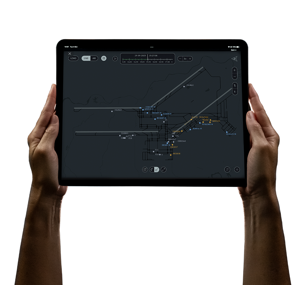
ROMEO5 Ground shows aircraft and vehicles on runways, taxiways and stands, colours each runway by its actual state, and gives the controller somewhere to record the traffic that carries no transponder at all.
One display, two modes
Ground is a button, not a second console.
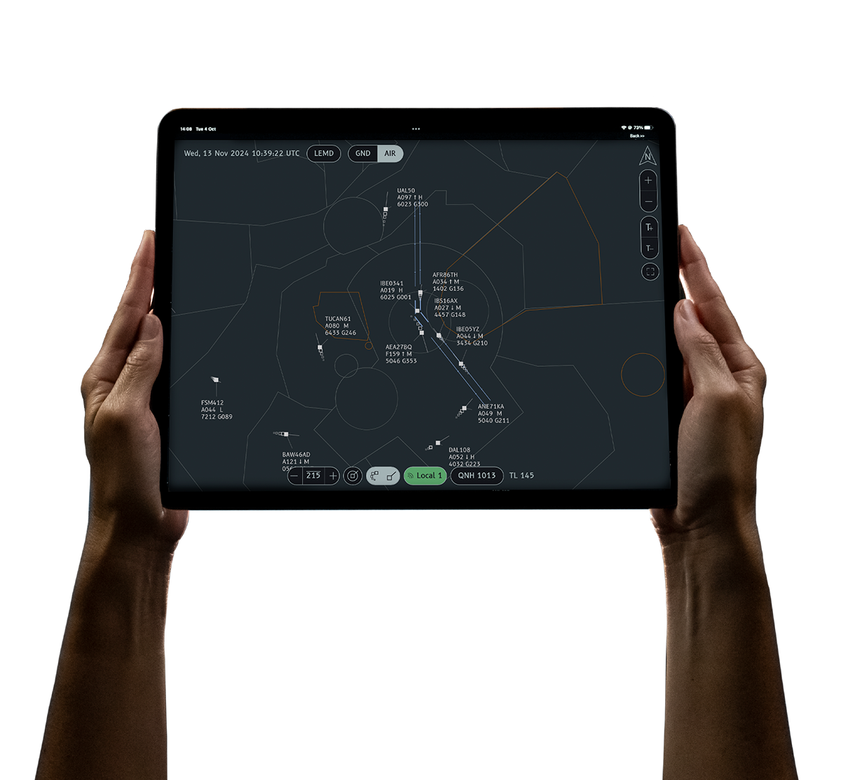
ROMEO5 Ground and ROMEO5 Air are the same display, configured differently. The controller switches between the air picture and the surface picture with one toolbar button — same screen, same hardware, same session, with every setting preserved.
Runway state
Legible in three places at once.
Every runway is painted by state — free, occupied or closed. The same state appears in the runway-configuration header, where each designator is tinted, and in a list card naming the ground vehicles currently on each occupied runway. The controller can close and re-open a runway from the toolbar; a closed runway is struck through in the menu and painted red on the map.
- Occupancy computed server-side on every one-second snapshot
- The vehicle list filters to vehicles only, so an aircraft lining up does not fill it with noise
- Low Visibility Procedures toggle available as a selectable layer
The part most surface displays skip
A shared, prioritised list of the traffic you cannot track.
Vehicles without transponders, works parties, anything the surveillance picture misses — the controller types it into a card on the display. Entries are free text, dragged into priority order, held per aerodrome and stored centrally, so a second working position sees exactly the same list within seconds.
It is an operational whiteboard rather than a personal scratchpad. Most surface displays simply do not model what they cannot see.
Tuned for the airfield
Not an air display zoomed in.
Vectors
Capped to plausible ground speeds
The 30-second speed vector is capped at 30 kt for aircraft and 10 kt for vehicles, so a spurious reading cannot draw a line across the airfield.
Trails
Short and recent
Ground mode keeps the last five positions rather than a long tail — the right amount of history at taxi speeds.
Labels
Deliberately minimal
Callsign plus size category. Vehicles and arrivals show the callsign alone, so the map stays readable when the apron is busy.
What it tells you
State indications, and one advisory alert.
ROMEO5 Ground continuously shows which runways are occupied and by which ground vehicles, which runways are closed, and which vehicles are exceeding the taxiway speed limit — raised as an advisory when a target inside a taxiway polygon exceeds a configurable threshold, set to 45 kt by default.
These support the controller's own judgement about incursion risk. They do not replace it. ROMEO5 Ground does not issue a collision or incursion alert, and nothing in it detects an aircraft landing on an occupied runway.
| Runway occupancy | State indication — polygon colour, tinted designator and vehicle list. No audible or modal alert |
|---|---|
| Runway closed | Operator marking. The map paints it red; nothing detects entry onto it |
| Taxiway over-speed | Advisory alert, threshold configurable per aerodrome (45 kt today). Recorded and reviewable afterwards |
| Surface conflict detection | Not provided |
Where it runs
The ground feature set is a cloud capability today.
ROMEO5 runs either in the cloud or as a self-contained on-premise unit. For the air picture the two are equivalent. For ground, they are not, and it is worth being straight about it:
| Cloud deployment | Full ground feature set — runway occupancy colouring, the vehicle list, runway close/re-open, the non-cooperative notes card, the LVP toggle and server-side occupancy and speed alerts |
|---|---|
| On-premise unit | Surface display with the ground/air mode toggle and runway configuration selector. The occupancy, list, notes and alert features are not present in the standalone build |
If you need the full ground feature set on your own hardware, talk to us before specifying — it changes the deployment.
Watch an apron work.
The demo runs the ground picture on live Madrid data.